Date:
Winter cold spells are often mistakenly pointed to as evidence against global warming. A common remark I’ve encountered this winter season is, “It’s so darn cold, how can the globe be warming?” It may seem counterintuitive, but while the globe continues to warm, erratic cold snaps at the middle latitudes may actually become more frequent.
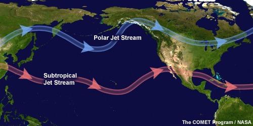
The reason for this lies in the changing behavior of the jet stream, stratospheric winds that circulate the earth’s poles. In the Northern Hemisphere, the jet stream circulates around the North Pole from west to east, undulating slightly from the north to the south as it flows. These circumpolar air masses make up the polar vortex.
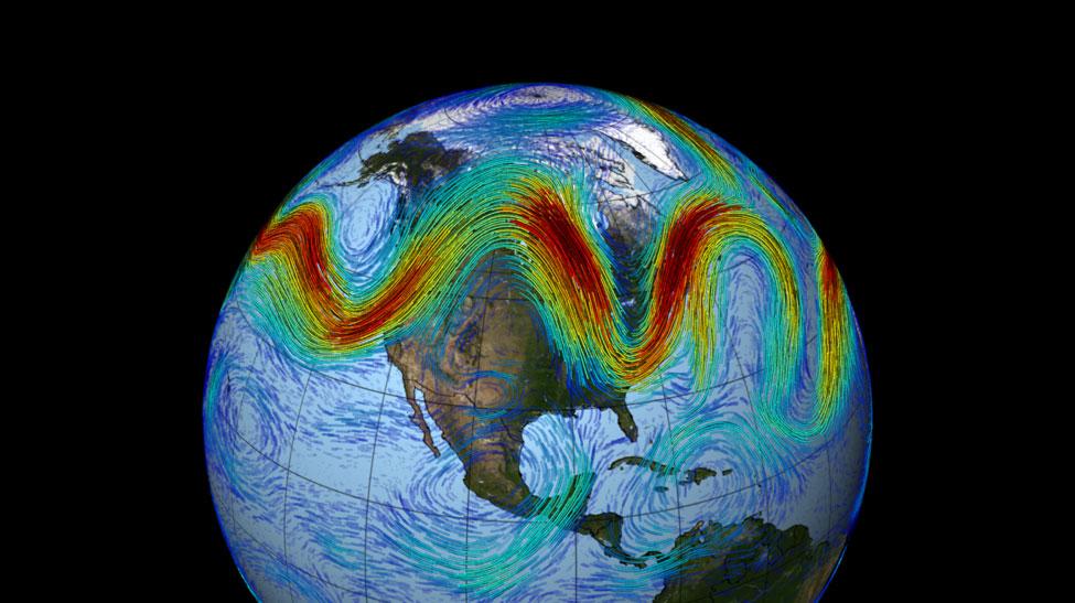
Differences, or gradients, in temperature and pressure drive vortex circulation. When those gradients are strongest, winds travel at high velocity and circulate tightly around the North Pole. As the Arctic region warms up, however, these gradients weaken and cause the polar vortex to sporadically disaggregate into lobed shapes (see figure).
This unpredictable vortex behavior is making weather forecasting a grand challenge and subjecting unprepared communities to sudden deep freeze. Prediction is made especially difficult by a phenomenon called Arctic amplification, which describes the trend of Arctic temperatures warming at twice the rate of temperatures in lower latitudes.
In a new study published in the Bulletin of the American Meteorological Society, Marlene Kretschmer of the Potsdam Institute for Climate Research, along with colleagues, has analyzed possible vortex states in the era of Arctic amplification. Authors performed cluster analysis on wind velocity data from January and February 1979-2015. (Cluster analysis is a statistical procedure used to identify the predominant states of the polar vortex, collecting similar spatial patterns of wind velocities into unique groups, i.e., clusters.)
Researchers find that, over their record, strong polar vortex states become significantly less frequent, while weaker states become significantly more persistent. Importantly, the authors link weak vortex states to observed extreme cooling trends in Eurasia, a finding made even more robust when considering tropical variability, like El Niño events, as well.
The finding is a significant advancement towards improving weather prediction capabilities as global warming progresses, which remains an area of great uncertainty and very active research.
Climate science is a complex and rapidly evolving field. Advances in computational and instrumental capabilities, coupled with scientists’ greater understanding of interrelated atmosphere and ocean dynamics, increasingly reveal the fingerprints of anthropogenic climate change on our evolving climate system.

An undulating polar vortex. Each line indicates wind velocity (red=faster, blue=slower). As global warming progresses and temperature gradients from the equator to the pole weaken, polar vortex wind velocities lessen and their circulation deviates from a circular pattern around the North Pole to a more undulating pattern. “Troughs” of cold Arctic air travel south, while “ridges” of warmer mid-latitude air masses are drawn north.
Source: NASA Visualization Explorer (psst! It’s freely accessible!).


